3D

A 3D Model for Every Building

When you search for a building, you see pictures and a map. However, If you were in a sci-fi movie, you’d probably see an interactive 3D model of the building. Google could bring us into the future.

This is a proposal for Google Maps to use their 3D imagery to build a collection of isolated buildings for use elsewhere on the web.

These isolated buildings could be used in Google search previews, embedded in Wikipedia pages, and downloaded for 3D modeling projects.

A diagram showing the isolated building (blue) being transcluded into other places on the web.

Here’s this same diagram with actual screenshots of the 3D view of One World Trade Center on Google Maps, with arrows pointing to where an isolated 3D model could be embedded.

The top section illustrations that this isolation could be pretty easily executed by extruding the footprint of every building up to the height of the building. This works for most buildings, since the footprint of buildings are typically larger than the top sections. For more complex buildings, however, these models could be manually isolated.

If you know anybody who works on the Google Maps team, please send this to them!

Feedback and other ideas are welcome in the comment section below!

Making 3D Cloud Imagery with Ground-based Imaging Systems

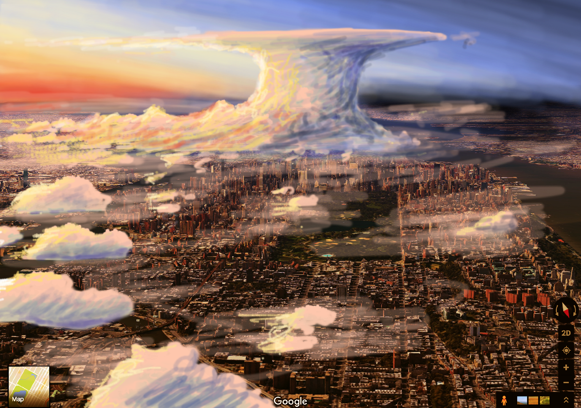
Imagine a weather app that lets you see detailed 3D models of the massive cloud structures above; the elegant wisps of cirrus, the bulky storm clouds as they roll across the sky… we have the technology to this, we just haven’t done it yet.

Perspective sketch of a cumulonimbus storm cloud above a city.

Perspective sketch of a cumulonimbus storm cloud above a city.

Screen Shot 2018-01-30 at 12.05.44 PM.png

The concept is simple: a network of cameras pointed at the sky, spread far apart from each other to capture different perspectives, and we use software to combine all the images into a live interactive 3D model.

This technique is called photogrammetry, and is widely used for making 3D models of surface features using aerial drones. 

Illustration of ground-based camera array using geometry to calculate three-dimensional cloud positions.

Illustration of ground-based camera array using geometry to calculate three-dimensional cloud positions.

Deployment

In terms of hardware, “Whole Sky Cameras” (wiki) could be used to capture hemispheric images of everything above the horizon. A live stream would then be setup, (similar to WU’s weather webcam system) and location data would be added to the webcam.

Initially, a company wanting to pioneer this idea could blanket one specific area with webcam coverage, as a proof of concept to showcase the 3D models. As the network grows, the site would automatically merge other people’s webcams into the global crowdsourced model.

Final Thoughts

Awe-inspiring sculptures of colorful sunsets, meandering tornados, and billowing volcanic eruptions — That’s what we can capture with this technology.

Not only would this satisfy the curious mind, this tech can also be valuable for research, atmospheric studies (meteorological prediction improvements, fluid dynamics) flight simulation models, etc.

If you'd like to contribute to this idea, feel free to share your github project in the comment section below (click here if you don't see the comment box) and with your permission I'll embed it in this article. 

Check out the video explanation of this idea, the outline in Workflowy, and join the discussion on Reddit and Twitter.

View this article on Medium.